File:Greater-Skyrdagor.png: Difference between revisions
Jump to navigation
Jump to search
A map illustrating the countries of Greater Skyrdagor (Skyrdagor: ''gilyjlydh Skyrdagor'' [ɟ͡ʝiɮʊɪ̯ɮɯð ɧɯ˞dɒː˞]) and their position inside Márusúturon. Ogotet'hep is shaded because about 38% of its population is ethnically Skyrdeg... |
mNo edit summary |
||
| Line 1: | Line 1: | ||
A map illustrating the countries of Greater Skyrdagor ([[Skyrdagor]]: ''gilyjlydh Skyrdagor'' [ɟ͡ʝiɮʊɪ̯ɮɯð | A map illustrating the countries of Greater Skyrdagor ([[Skyrdagor]]: ''gilyjlydh Skyrdagor'' [ɟ͡ʝiɮʊɪ̯ɮɯð ɧu͡ɯ˞dɒː˞]) and their position inside Márusúturon. Ogotet'hep is shaded because about 38% of its population is ethnically Skyrdegan, culturally close to people from Ajversziv. | ||
Revision as of 17:30, 17 March 2018
A map illustrating the countries of Greater Skyrdagor (Skyrdagor: gilyjlydh Skyrdagor [ɟ͡ʝiɮʊɪ̯ɮɯð ɧu͡ɯ˞dɒː˞]) and their position inside Márusúturon. Ogotet'hep is shaded because about 38% of its population is ethnically Skyrdegan, culturally close to people from Ajversziv.
File history
Click on a date/time to view the file as it appeared at that time.
| Date/Time | Thumbnail | Dimensions | User | Comment | |
|---|---|---|---|---|---|
| current | 17:19, 11 February 2018 | 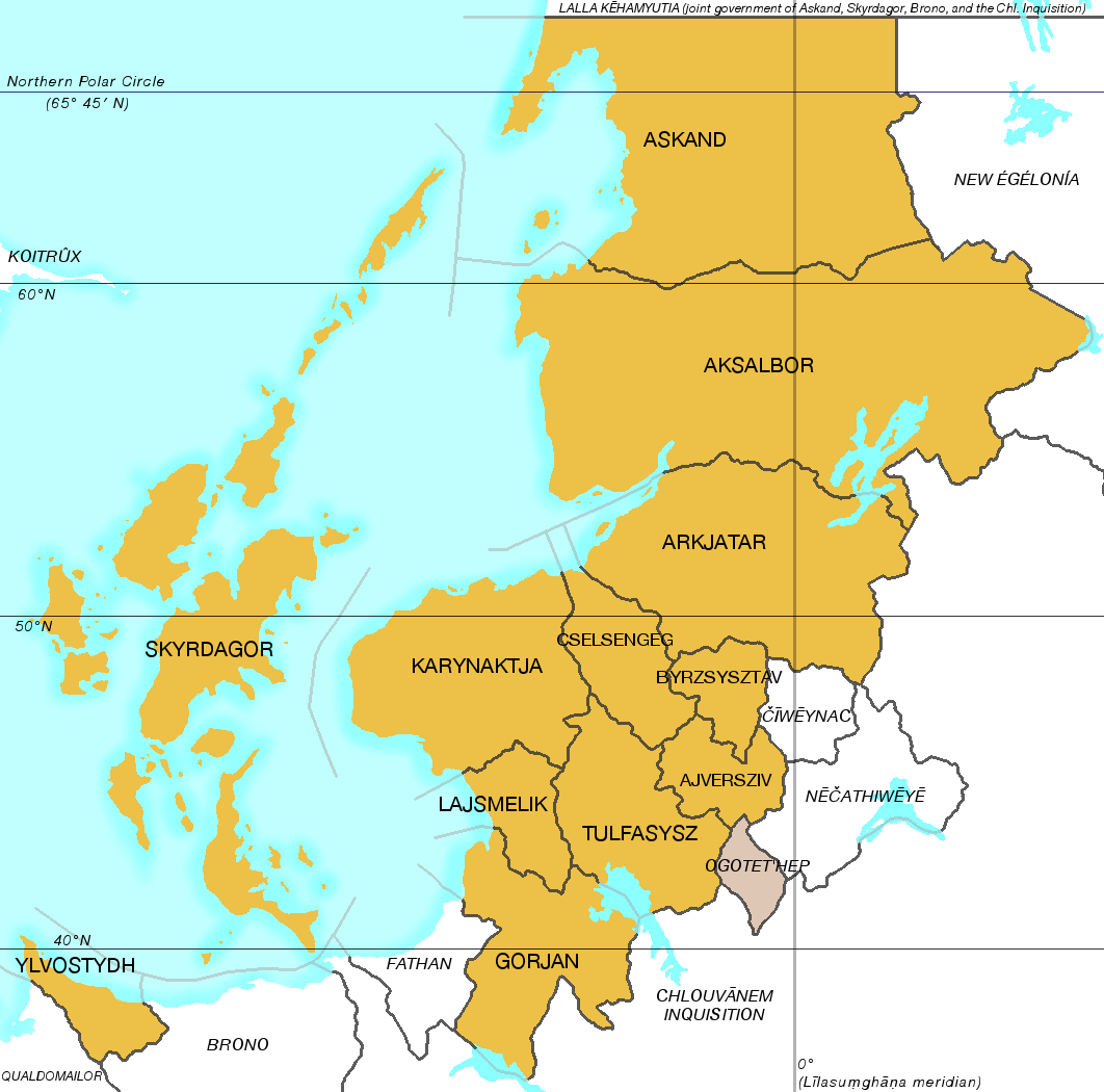 | 1,062 × 1,050 (168 KB) | Lili21 (talk | contribs) | A map illustrating the countries of Greater Skyrdagor (Skyrdagor: ''gilyjlydh Skyrdagor'' [ɟ͡ʝiɮʊɪ̯ɮɯð ɧɯ˞dɒː˞]) and their position inside Márusúturon. Ogotet'hep is shaded because about 38% of its population is ethnically Skyrdeg... |
You cannot overwrite this file.
File usage
The following page uses this file: