File:Inquisition-tribunals-dioceses.png: Difference between revisions
Jump to navigation
Jump to search
Political map of the Chlouvānem Inquisition with tribunals (coloured) and borders of dioceses. |
mNo edit summary |
||
| (5 intermediate revisions by the same user not shown) | |||
| Line 1: | Line 1: | ||
Political map of the Chlouvānem Inquisition with tribunals (coloured) and borders of dioceses. | Political map of the Chlouvānem Inquisition with tribunals (coloured and named) and borders of dioceses. The twenty largest cities of the country are also marked on the map. | ||
Latest revision as of 16:16, 15 November 2020
Political map of the Chlouvānem Inquisition with tribunals (coloured and named) and borders of dioceses. The twenty largest cities of the country are also marked on the map.
File history
Click on a date/time to view the file as it appeared at that time.
| Date/Time | Thumbnail | Dimensions | User | Comment | |
|---|---|---|---|---|---|
| current | 16:16, 15 November 2020 | 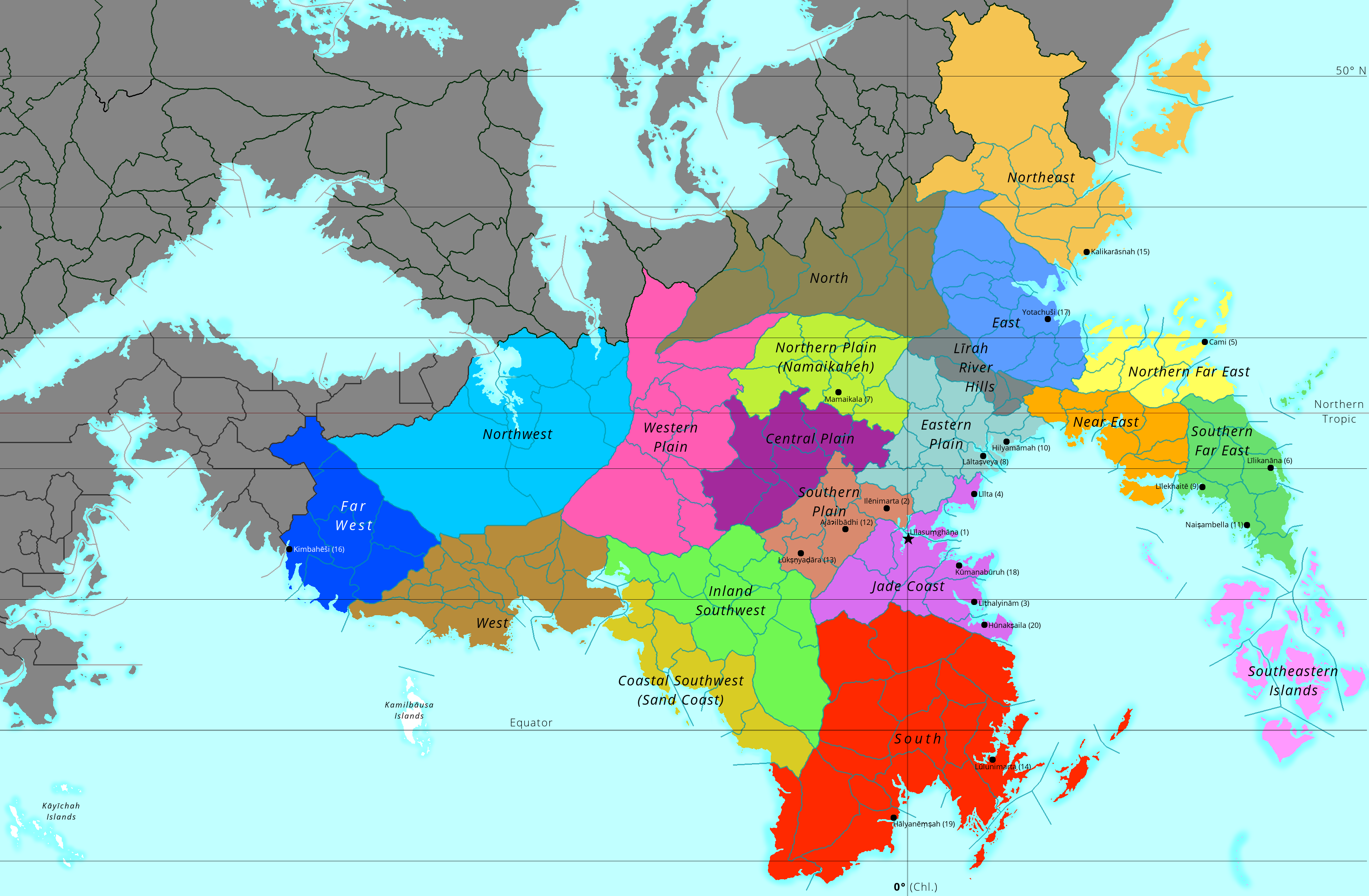 | 3,348 × 2,192 (901 KB) | Lili21 (talk | contribs) | Various conworld changes; more details added |
| 15:04, 26 December 2017 | 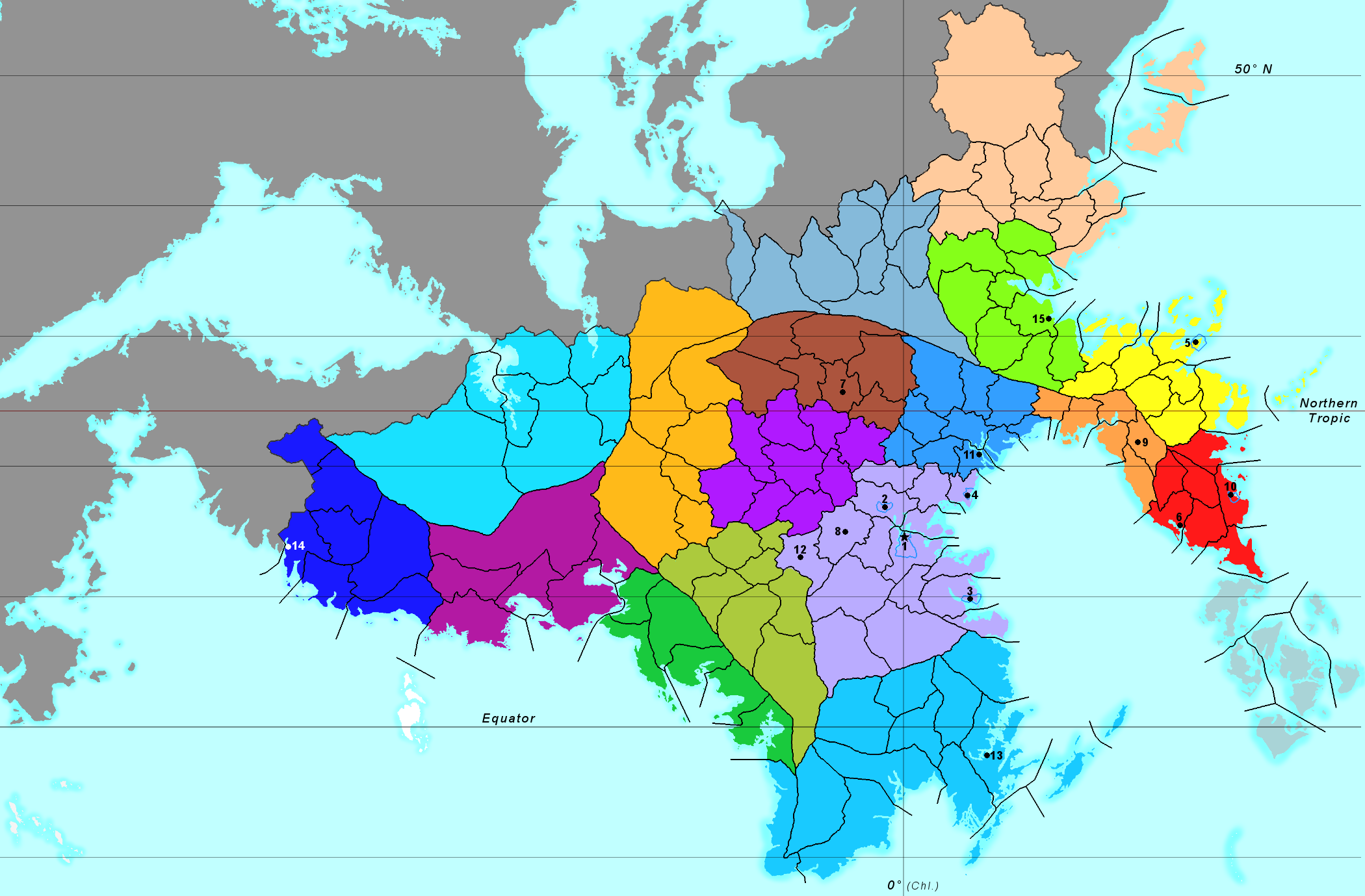 | 2,100 × 1,379 (693 KB) | Lili21 (talk | contribs) | Various border changes | |
| 11:08, 20 June 2017 | 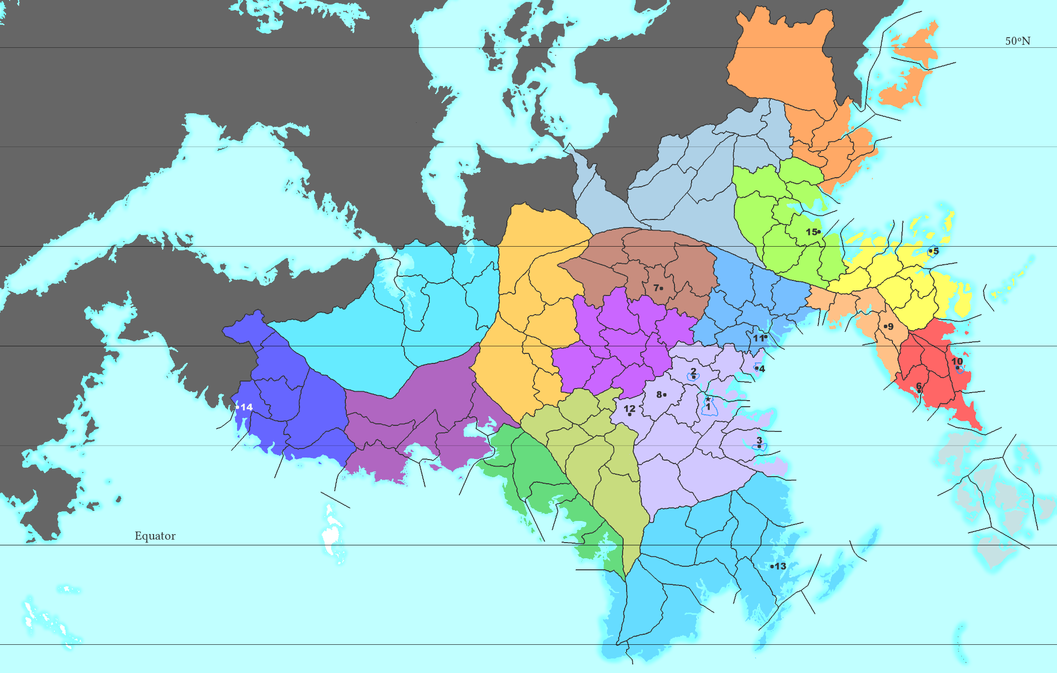 | 2,100 × 1,337 (679 KB) | Lili21 (talk | contribs) | ||
| 10:30, 26 March 2017 | 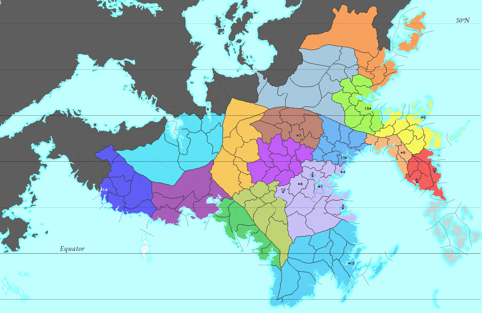 | 2,000 × 1,299 (772 KB) | Lili21 (talk | contribs) | Major conworld changes | |
| 20:01, 26 February 2017 | 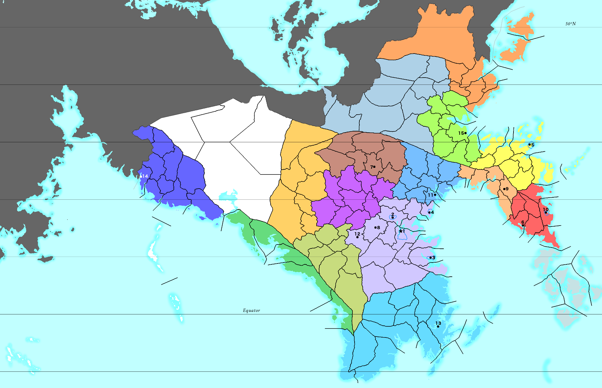 | 2,000 × 1,290 (570 KB) | Lili21 (talk | contribs) | Border changes | |
| 20:53, 9 February 2017 | 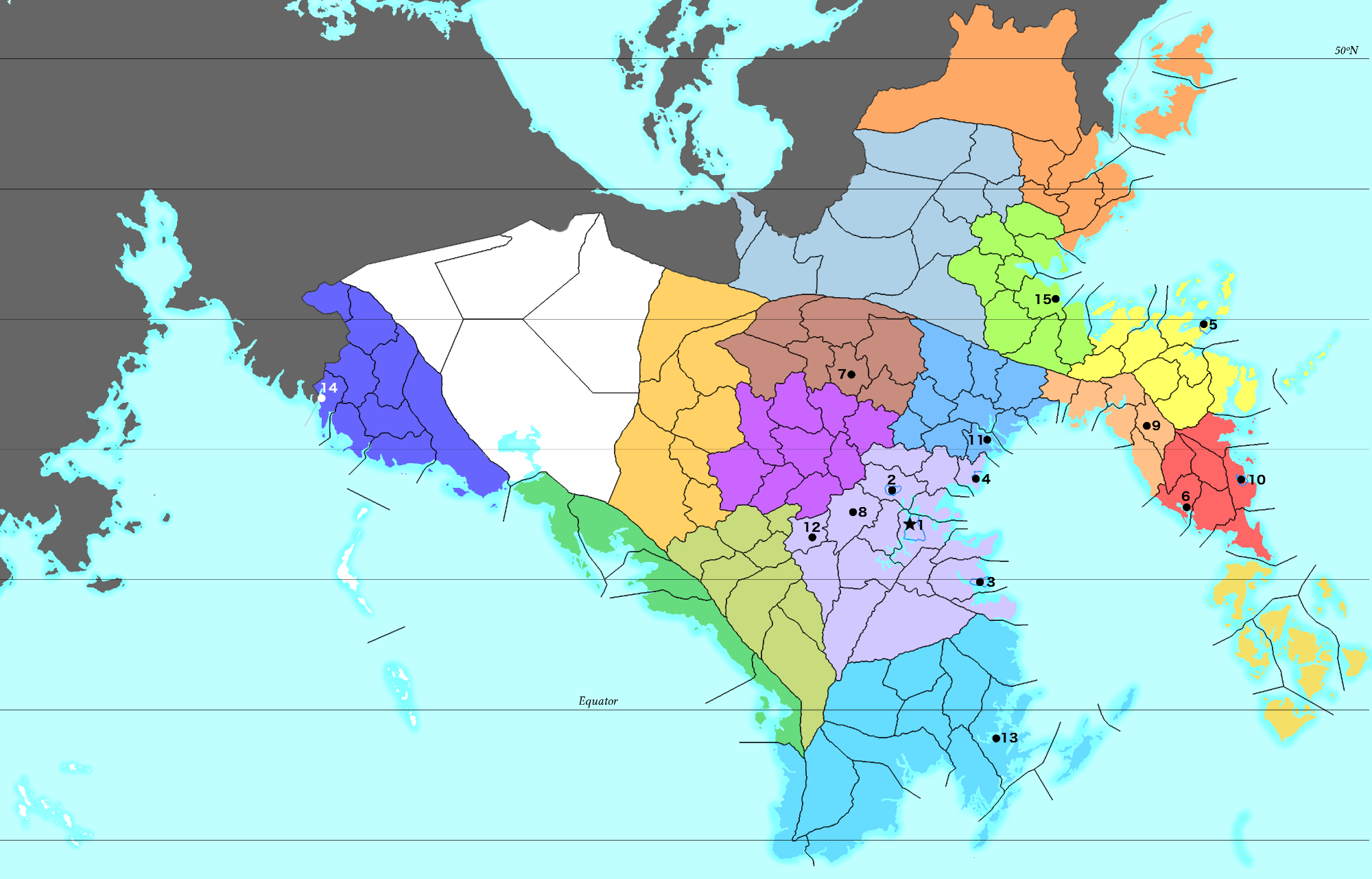 | 2,000 × 1,281 (581 KB) | Lili21 (talk | contribs) | Political map of the Chlouvānem Inquisition with tribunals (coloured) and borders of dioceses. |
You cannot overwrite this file.
File usage
The following page uses this file: